Severe flooding regularly hits different regions of the world. Earlier this year, parts of New South Wales in Australia witnessed a “once-in-100-year” event. In February 2020, excessive rainfall in England and Wales led to the wettest February since records began.
In the UK, the cost of floods and their management is estimated at over £2 billion per year on average, with over five million homes exposed to flooding or coastal erosion. These costs are feared to keep rising as state-of-the-art climate models project warmer, wetter winters [i].
Yet, to be able to project how floods might evolve in the future requires a sound understanding of how they have been changing in the recent past, as well as the causes of change.
Historical patterns of change
In recent work, we investigated how floods have been changing around the world since the 1970s [ii]. We used historical river gauge records at over 10,000 locations. These are measurements of the river flow rate obtained at daily intervals over many decades. At each location, we used these data to examine whether the magnitude, frequency, and probability of extreme river floods had been changing over time. We then investigated changes across the five main climate regions of the world: temperate, arid, tropical, polar, and cold climate zones.
Overall, we found that floods have mostly decreased at the global scale: their magnitudes, frequency, and probability of occurrence have been decreasing on average. However, these are just average values of change for thousands of locations. The reality is that there is tremendous variability in these patterns at local, regional and global scales.
In arid, tropical, polar, and cold climate zones, the floods that used to be considered “20-year floods” in the 1970s have today decreased between −33% and −12% on average. This is most visible in regions like north eastern Brazil, eastern Europe, parts of western US and parts of northern China. In these regions, many 50-year floods, as assessed in the 1970s, might now occur only once every ~150 years, on average. Decreases in river flooding may be caused by a range of factors such as flood control measures, groundwater depletion, and decreasing soil moisture, where drier antecedent conditions offset flood magnitudes.
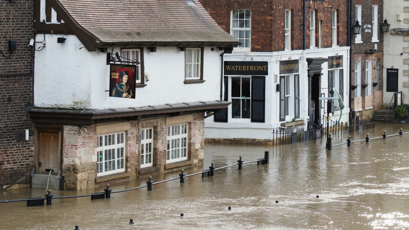
In temperate regions, however, such as the British and Irish Isles, we found that both the size and frequency of major river floods have been increasing since the 1970s. Floods that were considered 20-year events in the 1970s have now increased by 22% on average in regions such as Atlantic-facing Europe, south eastern Brazil, and south eastern China. In many locations, the “50-year floods of the 1970s” might now be expected to occur every 20 years, or even less (on average). These increases in flooding are likely to result from a combination of factors, such as climate change and variability, and urbanisation.


Why do these patterns matter, and what should we do?
Traditionally, engineers employ what are known as “stationary” methods to estimate river flood risk. This means the floods of today are considered to have equivalent characteristics to the floods of yesterday (in terms of their size and frequency of occurrence). But we know this is not strictly true. The characteristics of a flood are affected by a range of factors operating over different spatial and temporal scales, including changes in the climate, shifts in land cover such as urbanisation or deforestation, and human water engineering.
To obtain accurate flood risk estimates, there is growing recognition that we must consider these dynamic factors which may alter the characteristics of flooding over time [iii]. But there is still insufficient knowledge and research on how to incorporate these change factors into our estimates of future flood risk. So what should we do?
First, flood risk maps must be kept up to date. Major changes in flood characteristics have occurred in different regions around the world. This implies that former estimations of flood risk, based on data from the 1970s, or even the turn of the century, may no longer be accurate. Local risk estimates must be regularly updated to keep up with these changes and to protect people and their livelihoods.
For this to happen, good data are required. Historical river measurements are the foundation for accurate flood risk estimates, but they are not fully available everywhere. As a result, in many regions of the world we do not really know how the flood risk is changing. Data-rich regions, like the British and Irish isles, have historical measurements of river flow that may extend back 100 years in some cases. Yet some other countries have almost no freely-available data. There is a need to develop new ‘pooled’ methods that can shed light on how floods might be shifting in different environments.
Finally, perhaps most importantly, it is essential to continue working on the complexity of factors that cause flooding. The overwhelming majority of studies that project future changes in flood characteristics base their results principally on climate model outputs, which can tell us where the climate is becoming warmer, wetter, or drier on average. But climate models only provide part of the picture – namely, the large-scale patterns of change.
There is currently a major gap in flood science, which is understanding how the combined effects of local and large-scale flood drivers might affect future flooding
What many models and studies omit are the complex local factors that affect flood risk, such as urbanisation, de/afforestation, changes in population dynamics, water management, and flood control measures. Often, the impact of these local factors may outweigh that of changes in temperature and rainfall, and the interaction between these large and local scale mechanisms is poorly understood. This is leading to flawed projections of future flood risk.
There is currently a major gap in flood science, which is understanding how the combined effects of local and large-scale flood drivers might affect future flooding, especially in data-sparse regions. More funding and research needs to go into developing hybrid models which take advantage of the strength of climate models to predict and explain large-scale phenomena, and the strengths of machine learning and artificial intelligence to estimate the probabilities of extreme events, conditioned on observed historical measurements.
- [i] Environment Agency (2020). National Flood and Coastal Erosion Risk Management Strategy for England.
- [ii] Slater, L., Villarini, G., Archfield, S., Faulkner, D., Lamb, R., Khouakhi, A., & Yin, J. (2021). ‘Global changes in 20‐year, 50‐year, and 100‐year river floods’. Geophysical Research Letters, 48(6), e2020GL091824.
- [iii] Environment Agency (2021). Rapid Evidence Assessment of Non-Stationarity in Sources of UK Flooding.